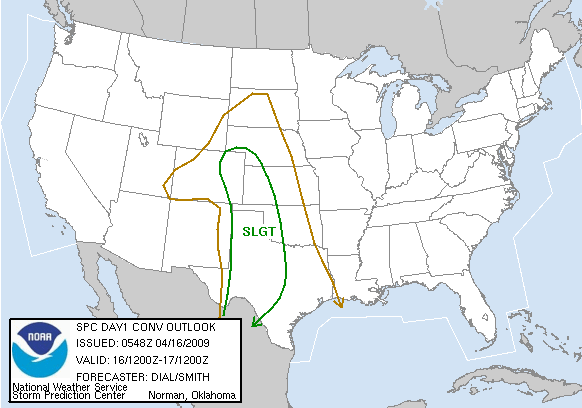
Caprock Magic gives us supercells galore on a day with lacking moisture, but they're of the HP variety with brief, hard-to-see spinups the only daytime tornadoes.
Observed 1 tornado.

The day started out with tempered expectations due to very lackluster moisture return, yet again. Surface dew points were expected to reach the 54-56 deg. F range over W TX, and anything more would be gravy. So despite decent shear profiles, the forecast maximum CAPE values of 1000-1500 J/kg were not particularly encouraging for tornadic prospects; I was mainly looking for structure and an excuse to chase the Caprock for the first time in forever.
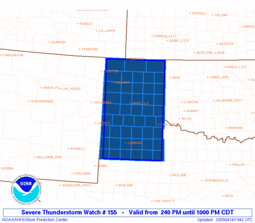
Sam Dienst, Brandon Lawson and I left Norman around 8am and headed westbound on I-40, later meeting up with Kiel Ortega. We headed to Shamrock, then dropped south on US-83 to Childress and grabbed a quick lunch. At that point, cloudcover and particularly unappetizing moisture return over the Panhandle suggested we should continue a bit farther S; down towards the I-20 corridor (and even as far N as Lubbock), dew points were already beginning to reach the mid to upper 50s. So we continued down to Guthrie (in King Co.), then took US-82 W towards Dickens, since the dryline was still holding back near the TX/NM border. We ended up continuing on to Crosbyton, about 30 mi. E of Lubbock, where we made a pit stop before relocating just W to Ralls. From there, we watched towers going up to our N, W, and S. A storm that had developed a bit earlier was now supercellular and tornado-warned as it moved through Swisher and Briscoe Co. to the N, so for awhile we were slightly concerned that dropping so far S may not have been a good choice.
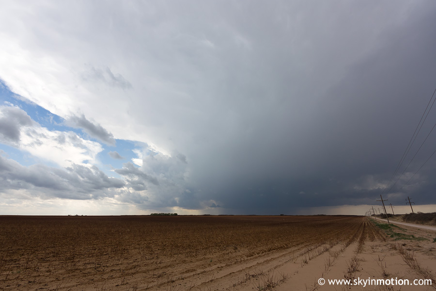
Not too long after we'd stopped in Ralls to watch and wait, new convective initiation appeared to our S and SW. While these storms initially struggled to develop supercellular characteristics (probably at least in part due to so many cells going up in close proximity), one started to get its act together as it approached Lubbock from the S. Below is our view looking W from just SW of Ralls.
At the same time, more storms had initiated a couple counties S of our position, and they quickly developed a more classic radar presentation than the cluster of slowly-organizing supercells we were dealing with. But just as we began to bolt from the Lubbock area, one of the cells we had been watching (I believe the left split from the storm photographed above, but can't remember for sure) rapidly developed a substantial wall cloud and became tornado-warned.
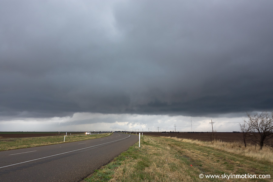
As we moved a tad W to get a closer view, an interesting appendage developed, but seeing as we were 15-20 mi. E of the storm base it was hard to tell exactly what it was. We continued W on some rather poorly-maintained backroads, keeping an eye on two supercells: one to our WSW immediately over Lubbock (wall cloud pictured below), and another just to our NW which exhibited a very broad and low base but no discernable lowerings.
Having dropped S earlier, we were now zig-zagging our way N and W in order to approach these cells, and eventually made our way back to US-82 near Lorenzo. By the time we did, we were becoming impatient with the lack of visual improvement on either storm, and so we began hauling E to make another attempt at intercepting the southern batch of storms now over Garza Co. Not three minutes after making that decision, a new velocity scan from KLBB indicated a probable tornadic circulation with the northern of the two Lubbock-area storms - it was no more than 5-7 mi. to our NW, but obscured by precipitation from our vantage point. This began an hour-long cat-and-mouse game in which we would repeatedly get fed up and begin heading S towards the other storms, only to be drawn back by improved radar appearance and/or NWS warning text regarding the Lubbock storms. By the time the afternoon was over, we knew the roads of western Crosby Co. far better than we'd ever hoped to, because we must have circled around the general Ralls-Lorenzo area about five times in our utter hopelessness!
Eventually we decided to cut our losses and stick with the Lubbock/Crosby Co. storms, as the southernmost storms had not produced any tornadoes in the 1-2 hrs. since their inception, despite very impressive radar presentation. We stopped along US-82 just W of Lorenzo to watch as a very HP supercell with a nearly ground-scraping base approached from the SW. It was a bit ironic that moisture had been the primary concern for the day, and we were now dealing with LCL's too low to see anything! Of course, the reason for this was not a sudden surge of unexpected low-level moisture, but rather very cool temperatures in the wake of the first cell that had already moved over this area over the previous half-hour or so. The result was a frustratingly messy-looking storm for us to watch as we shivered in the 58-60 deg. F temperatures.
After watching the above for a few minutes, I basically resigned myself to seeing little more of interest for the rest of the day. Eventually, yet another (HP) supercell moved in from the SW, and we watched a very broad and disorganized-looking area of rotation from US-82 near Ralls. Other chasers documented at least one tornado of the transient, nearly-invisible spinup variety near this location; unfortunately, I was hardly even paying attention at the time because I was so tired of watching ugly, benign-looking lowerings under ugly, cold, ultra-HP storms all afternoon, but I'll count one tornado for this chase given that we were in fact watching the area of rotation when the reported tornado occurred. From the video captures I've seen, it probably wouldn't have been worth getting the camera out for even if I had been paying more attention!
By 6:30pm, we began heading back E with the storms. As we dropped off the Caprock just E of Crosbyton, we encountered some fairly thick upslope fog that made for an interesting driving experience for Brandon. We dropped SE towards Spur to check out a tornado-warned storm moving into Kent Co., ultimately making it as far as Clairemont before darkness set in and we called it a day. For better or worse, our adventures were not entirely over, though: Sam's SUV was running very low on fuel by this point, which is not a particularly desirable situation in rural NW TX. We began heading E on US-380 and stopped in Jayton - the county seat - only to find there was not a single operational gas pump in town. So it was on to Aspermont, another 30 mi. E, where we pulled in on fumes and were fortunate enough to locate the single open gas station in town. After picking up some junk food there to substitute for dinner, we began the trek home and arrived by 1:30am.