

Started the day in York, NE, after chasing IA the day before. Driving nearly the length of I-80 in NE to jump from one 2% setup to another wasn't on my bucket list, but it's June and duty calls! After a quick lunch in LBF, I pressed on to the I-80/I-76 junction, turned SW, and eventually committed to the desolate and generally annoying off-interstate jaunt from Brush to Limon. Before I was done with that stretch, the initial bird farts shortly after CI were occurring near Elbert. By the time I raced through Limon and started W on CO-86, the tornado warned storm rolling out of the foothills exhibited every hallmark of the chaser colloquialism "cold supercell:" sprawling, broad, shelfy and HP, with not a patch of blue sky to be found around its periphery. Oh, and a jacket was mandatory for viewing... in the inflow! Part of my original rationale for bothering with the previous day in IA was that I could follow it with what had looked like a legitimate upslope tornado play on 6/21; now, the reality of how badly the setup had crumbled during the preceding 36-48 hours smacked me in the face like a gust of the 64/44 mile-high airmass.
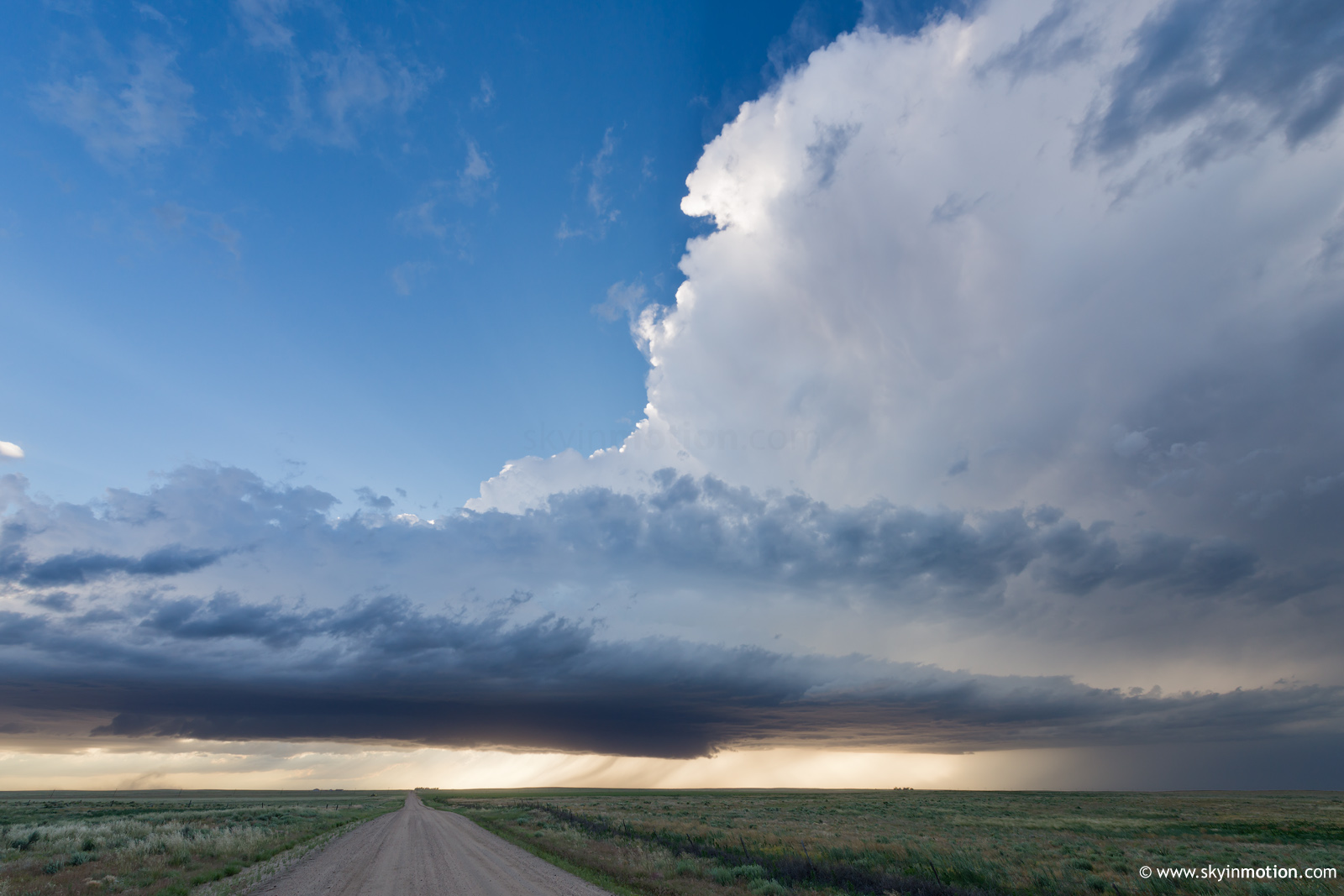
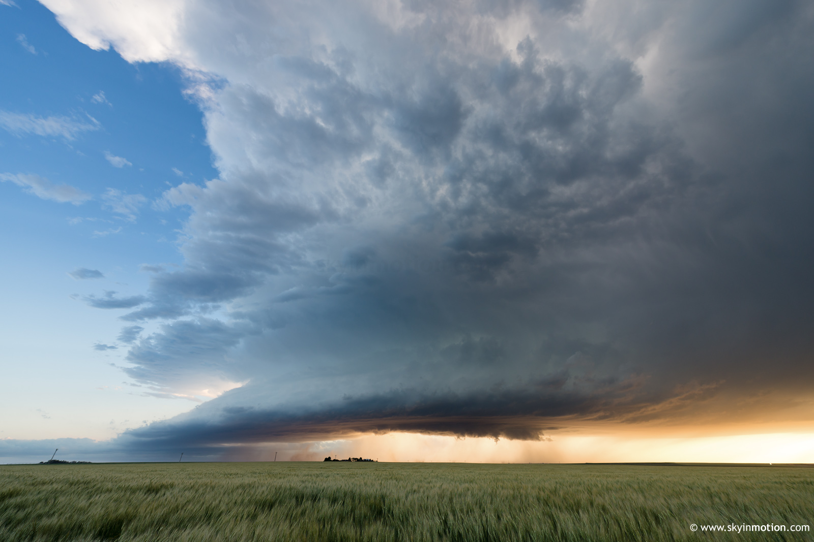
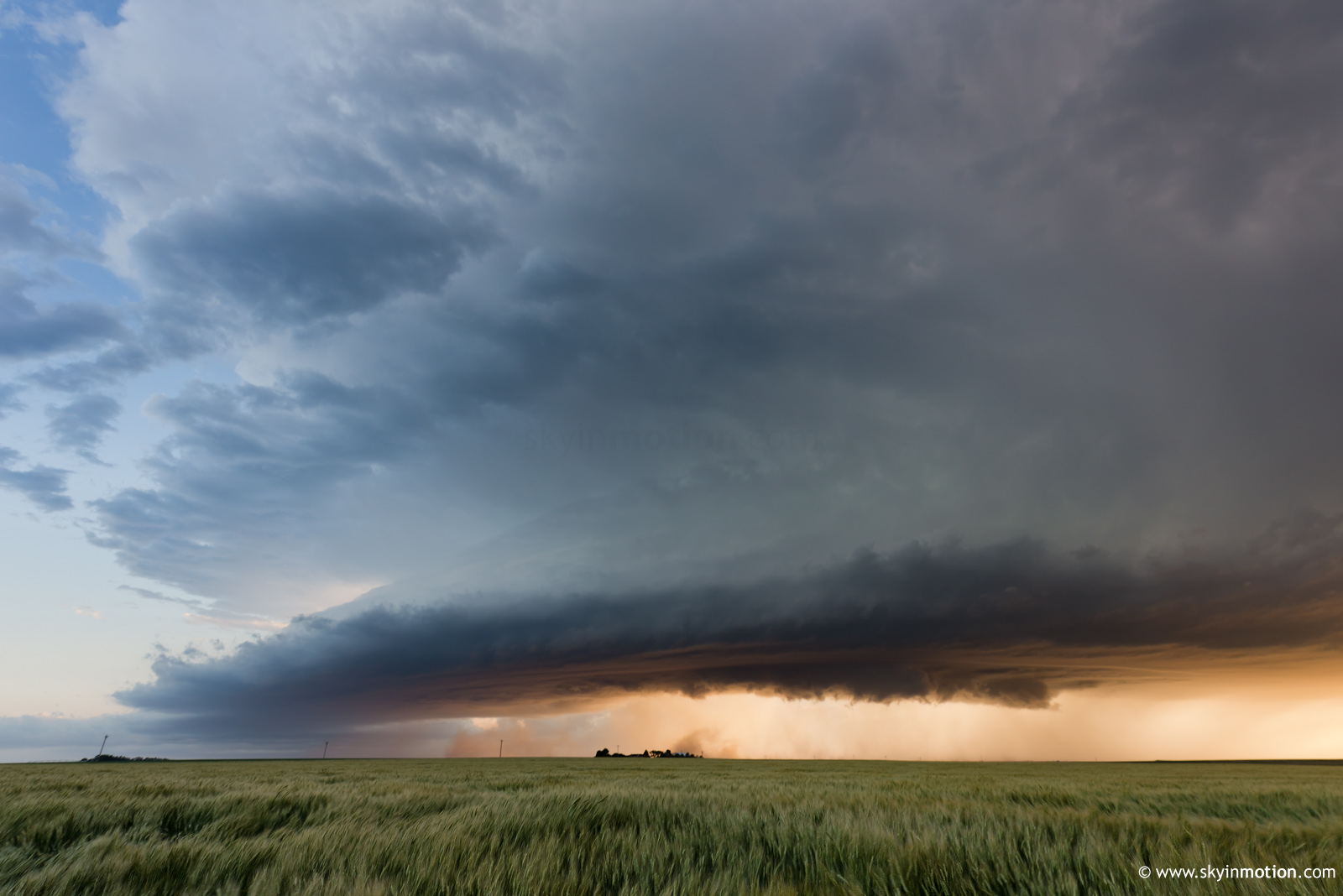
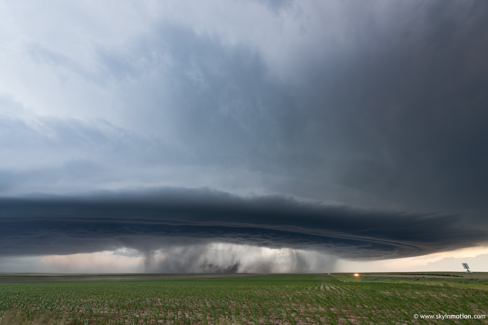
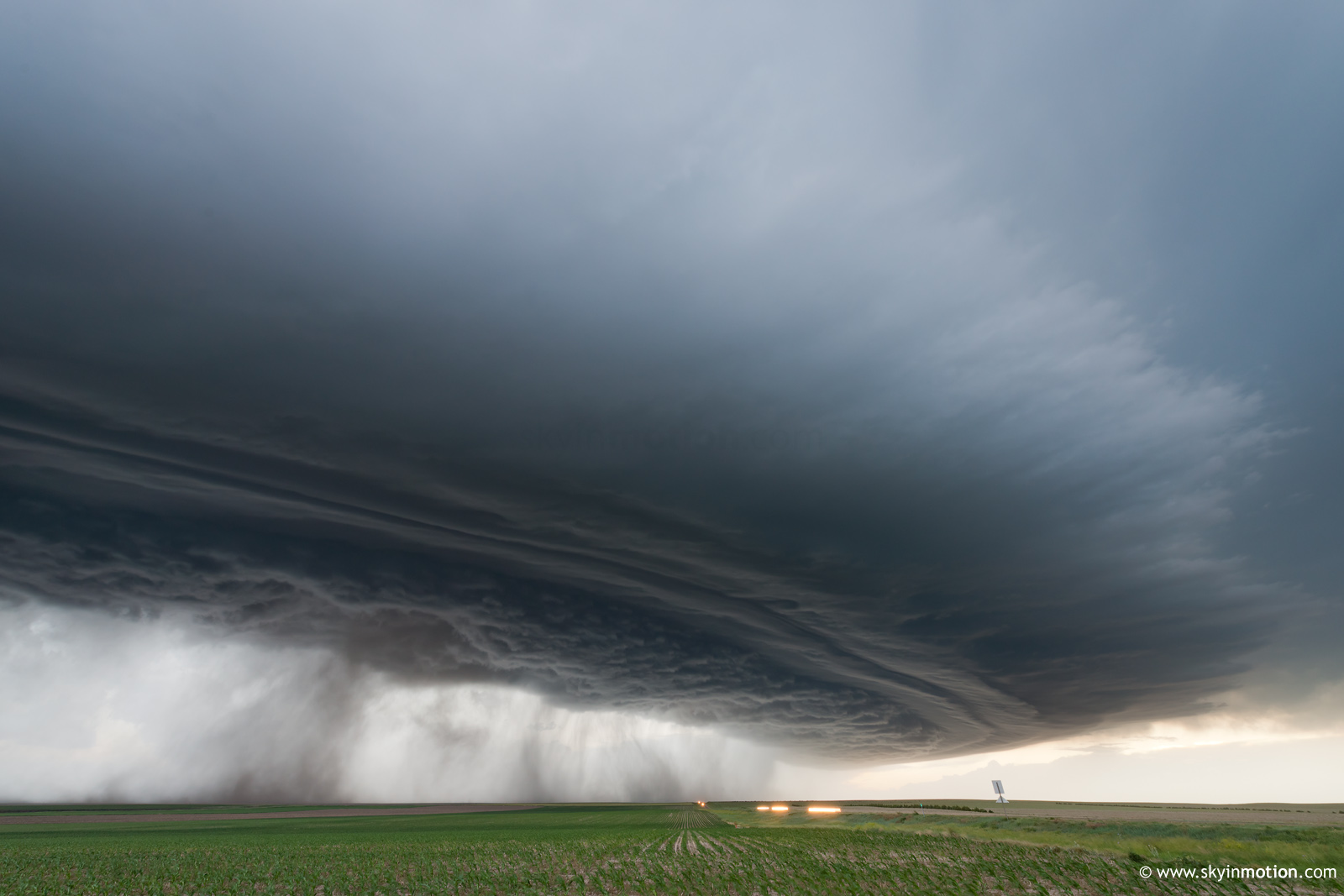
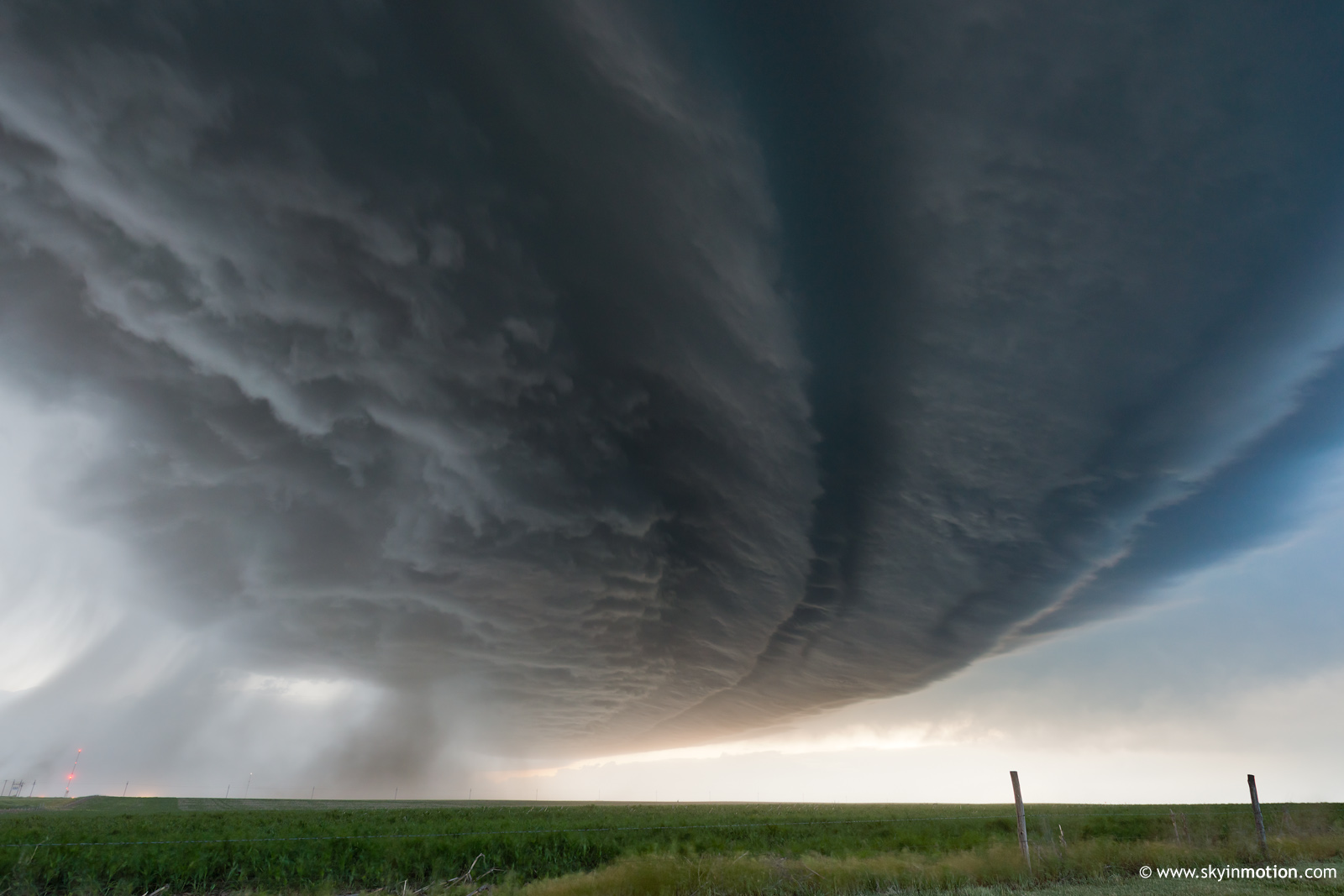
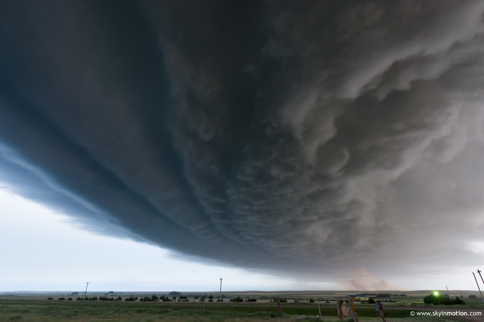
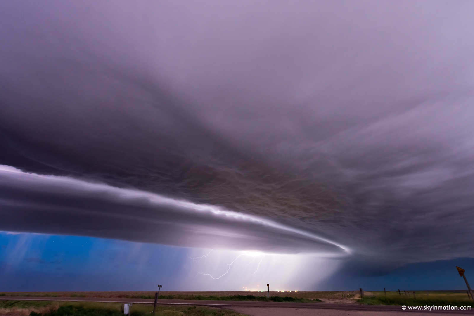
I reluctantly pressed SE on US-40 out of Limon to stay ahead of this clunker of a storm until it finally put us (meaning myself and the 230 other chase vehicles on the same thoroughfare) out of our misery and dissipated down near Kit Carson. I think I must've sat in a gravel lot near the US-40/US-287 intersection for close to an hour at that point, exhausted and ambivalent, considering a range of options for motels and whether I should prioritize distance, proximity to clear skies to bail and target Milky Way photos, or just price. This was around the 6pm hour, and I was fully checked out mentally by this point. The only reason I didn't compound an already unpleasant situation by bailing early was indecision, honestly. Around the time I'd decided it best to stick with a motel on I-70 in NW KS (thereby relieving any pressure to bail early, since it was nearby), a new updraft separate from the remnant Elbert/Limon cell shot up to my SSW near Eads. In short order, it looked impressive enough to convince me there was no reason to rush off for dinner and rest. Over the 2-3 hours that followed, this storm morphed into a fascinating and photogenic outflow-dominant yet "dry" supercell that propagated at speeds *well* in excess of the mean deep-layer flow and followed US-40 all the way from Cheyenne Wells to past Oakley -- at times, seemingly in excess of 50 mph, as it was simply impossible not to lose ground on it blasting E around the 70 mph speed limit with periodic photo stops limited to a couple minutes each. Below is a series of stills showing its evolution over this period from about 7:30-9:30pm MDT -- visually and structurally, it was remarkably steady state over that window, so the lighting conditions and my storm-relative position are responsible for most of the visual changes.
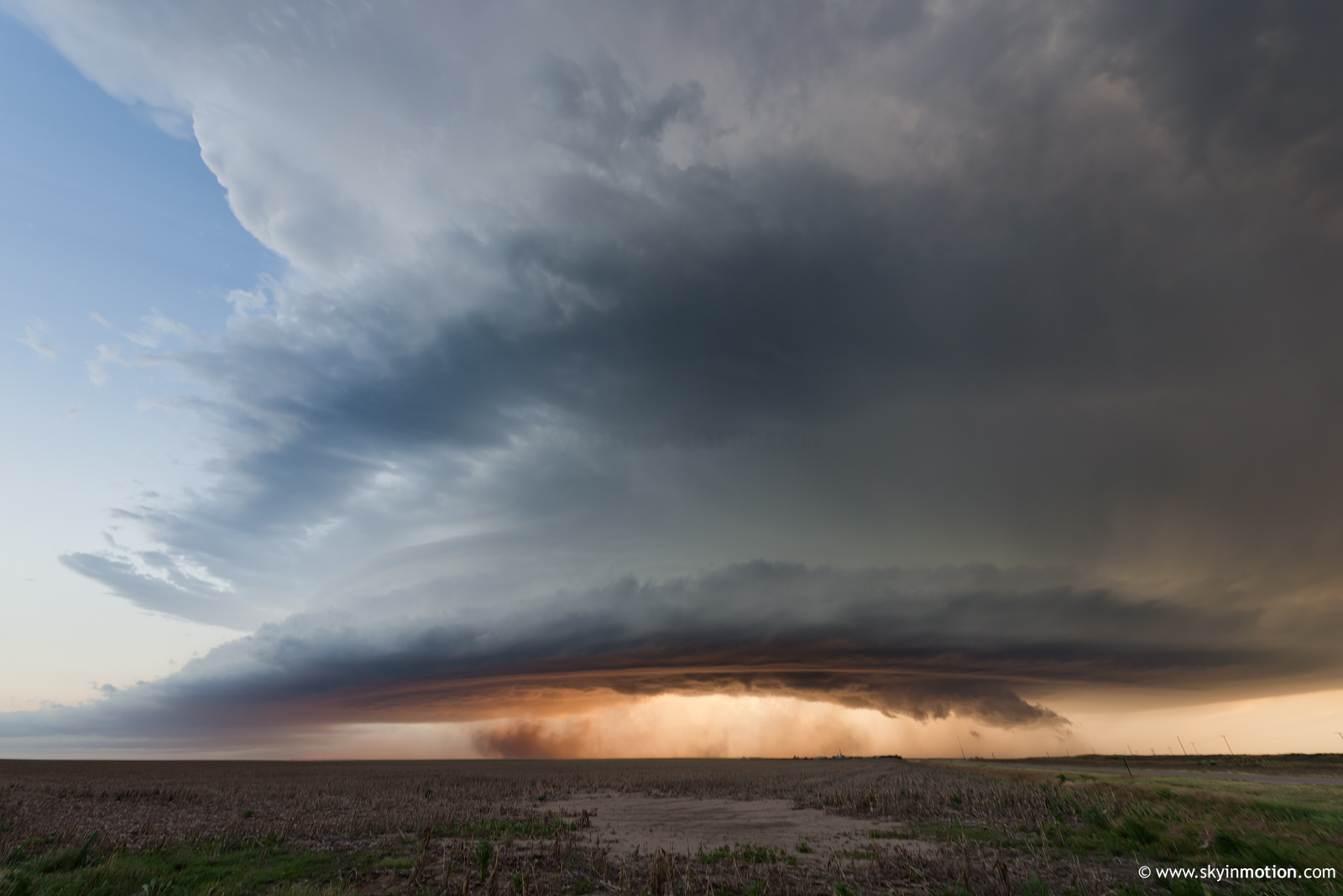
Near Cheyenne Wells, CO:
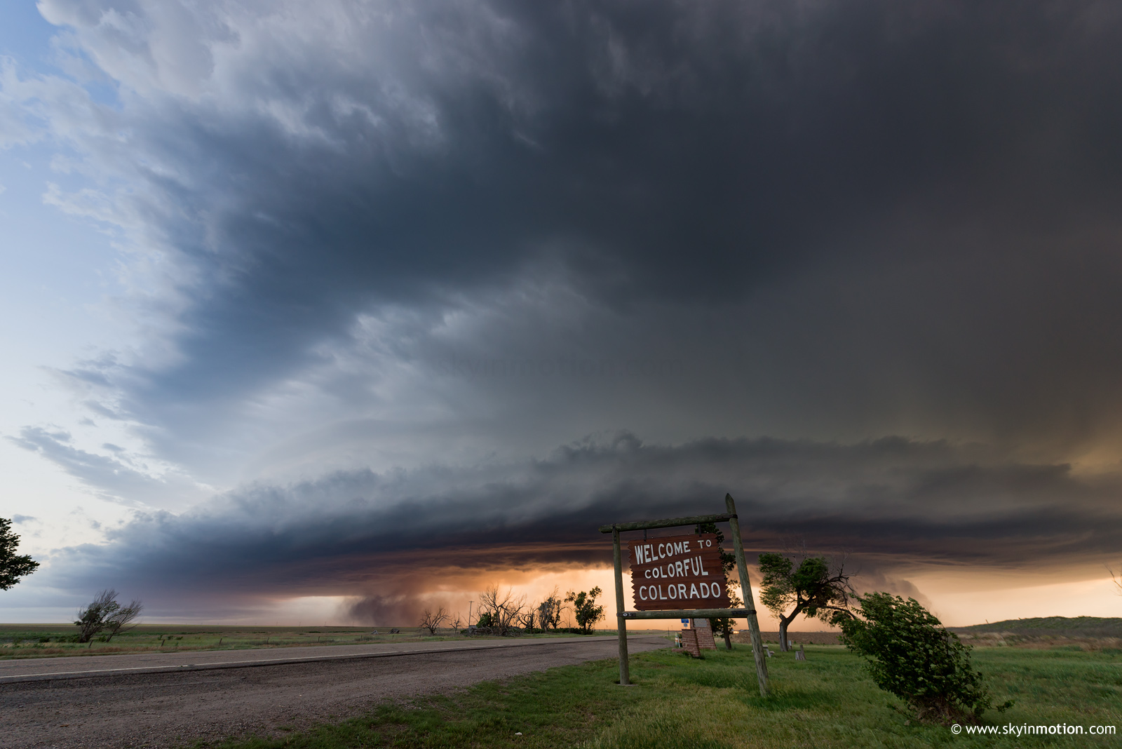
At CO/KS border:
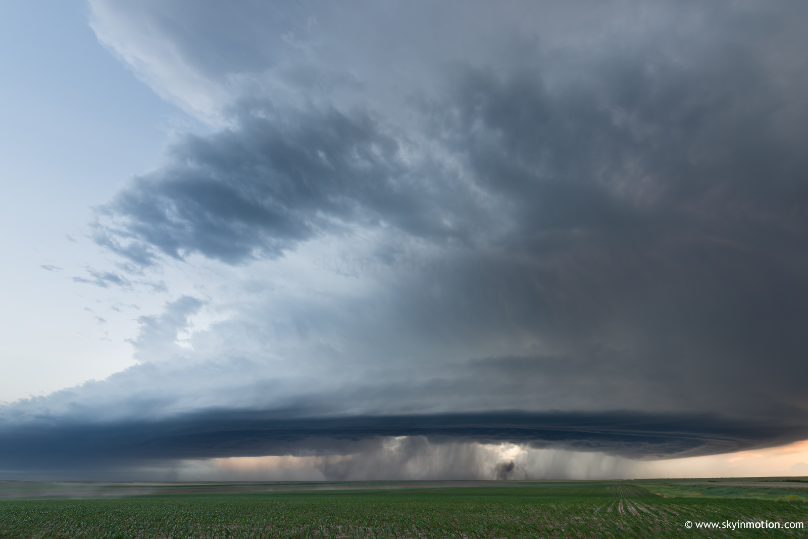
Just west of Sharon Springs, KS:
Just east of Sharon Springs, KS (outflow has overtaken me here):
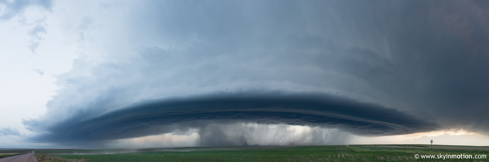
Near Winona, KS (within a mile of where I shot many photos of the 6/8/19 supercell only two weeks earlier):
Ultimately, this was another 2019 chase day for me that started rather miserable and quickly revealed itself as an unlikely tornado producer, but then redeemed itself late with a long period of structure/photo ops in golden hour light. It's been so long since I've seen a high quality tornado from a good perspective that I'm probably getting more jaded and complacent than I should about these kind of days, but even so, this was a really enjoyable storm. CAMs had been extremely consistent in depicting broad but intense UH swaths emanating from the upslope activity by the 23-02z period, and while the initial Elbert storm dissipated and made it a harrowing wait, that forecast ultimately verified (even if reality was displaced a bit E of guidance). One thing I've noticed during the CAM era is that these fat (~15 mi. wide) but high magnitude UH tracks in a postfrontal/upslope regime quite often portend big, photogenic storms that compensate for their lack of tornadic potential with highly exposed and impressive updrafts.