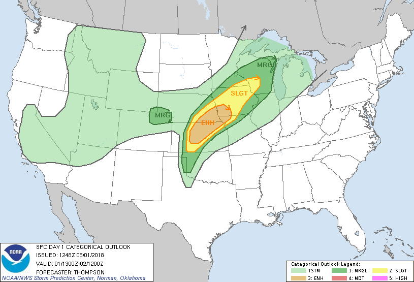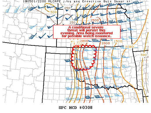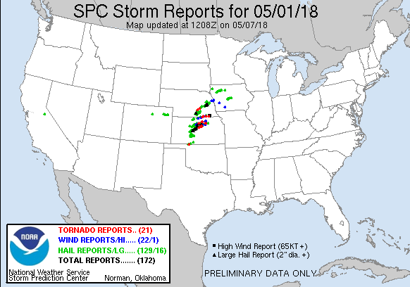
I came, I saw (nothing), I left. Only thing that could've made this day worse was if the Salina-area supercell had been a prolific cyclic producer of photogenic hoses. Instead, it "only" produced what still proved to be the best tornado of the season S of the I-70 corridor -- though that's more a testament to 2018 being among the worst seasons on record than anything. I left Norman as soon as I got off work at 4pm feeling pretty good about intercepting a tail-end charlie right before sunset NW of ICT, given CAM guidance at the time. That storm began rapidly dissipating as I approached downtown, so I veered SW and made it to Medicine Lodge just in time for another cell (which had produced a brief but miraculous tornado during its incipient LP stage earlier) to crap itself as I met it. Made it home around 12:30am I think and got a respectable night's sleep before bustola round 2.
Also noteworthy: this was my first chase outing of any kind since March 25, making 2018 my first chaseless April after 13 years.