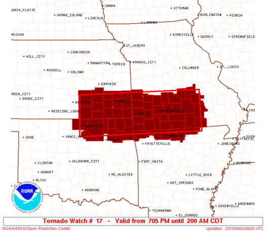
Observed 1 tornado.
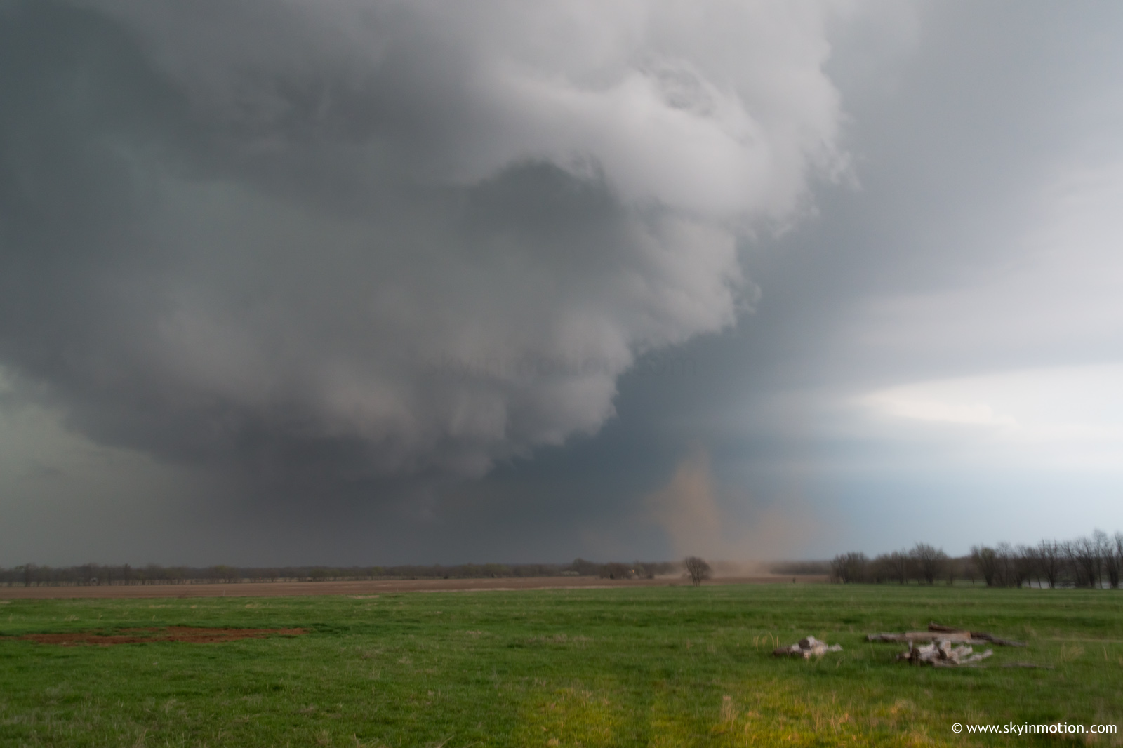
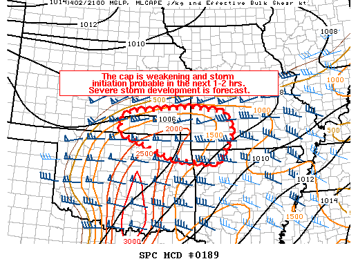
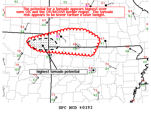
Left Norman around 2:30pm with Derek Stratman and took the turnpike to Owasso, then US-169 to Coffeyville where we spent a bit more time awaiting initiation than I'd hoped. Thankfully, the storm of the (pre-darkness) day was kind enough to develop just to our N, so we had a good, stress-free pursuit from the get-go. I was fairly impressed with how quickly a large, blocky wall cloud developed after the storm started taking off around 7pm. It looked like it might get the job done quickly between Mound Valley and Parsons, but repeated mergers with new updrafts developing in its inflow spoiled the show for awhile. Not long after the final merger, a funnel descended just E of Altamont. We fortuitously chose the gravel N option off of US-59 where the ground circulation touched down, so we had a front-row seat to the show, meager as it may have been.
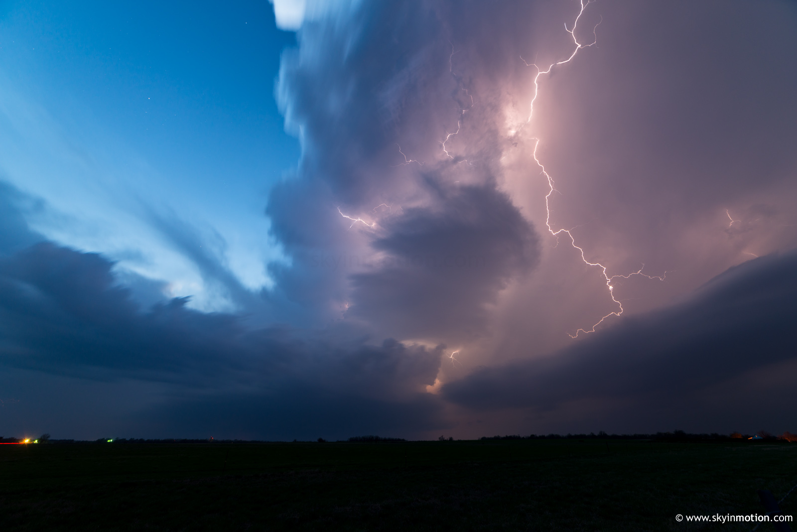
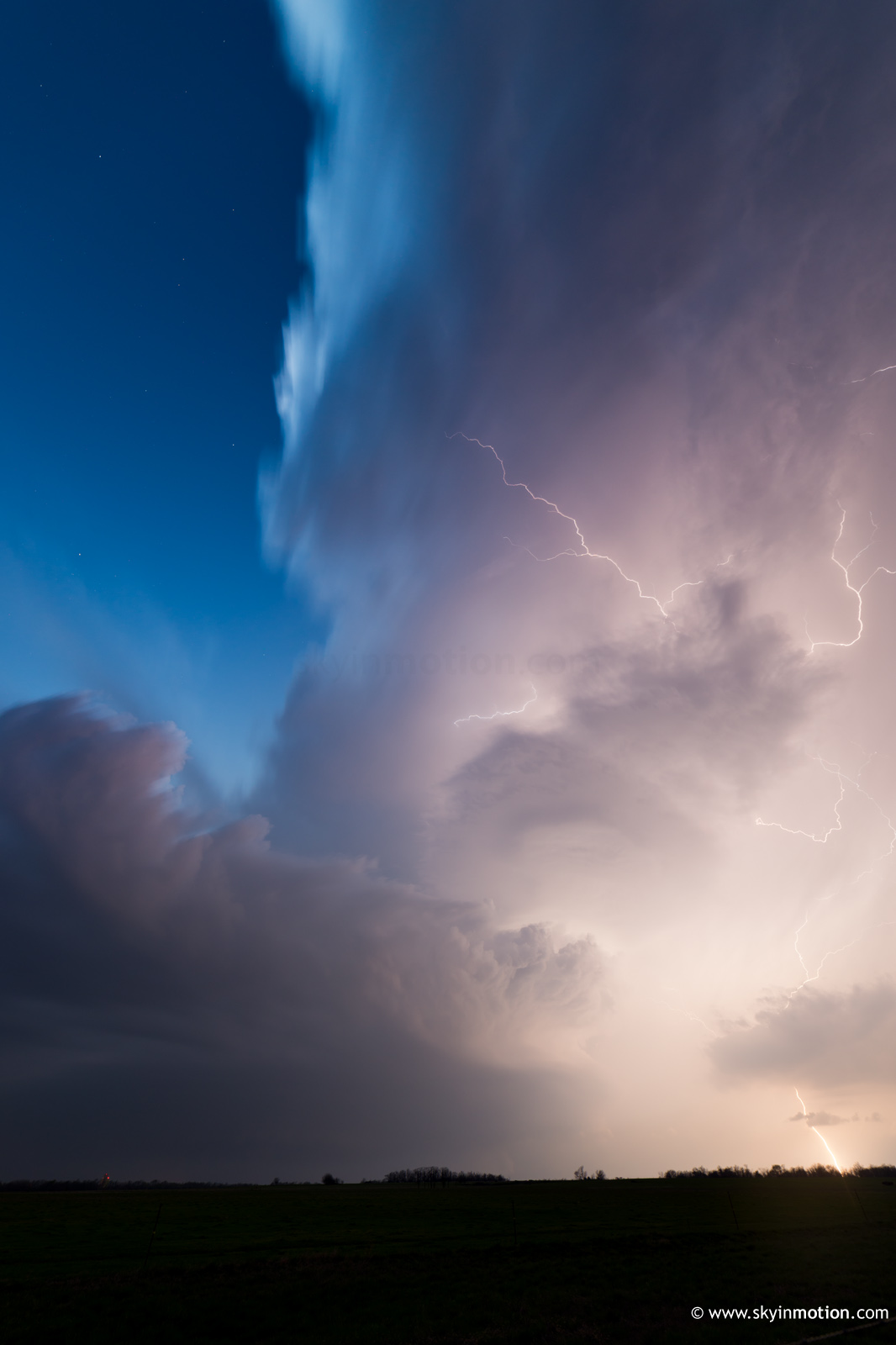
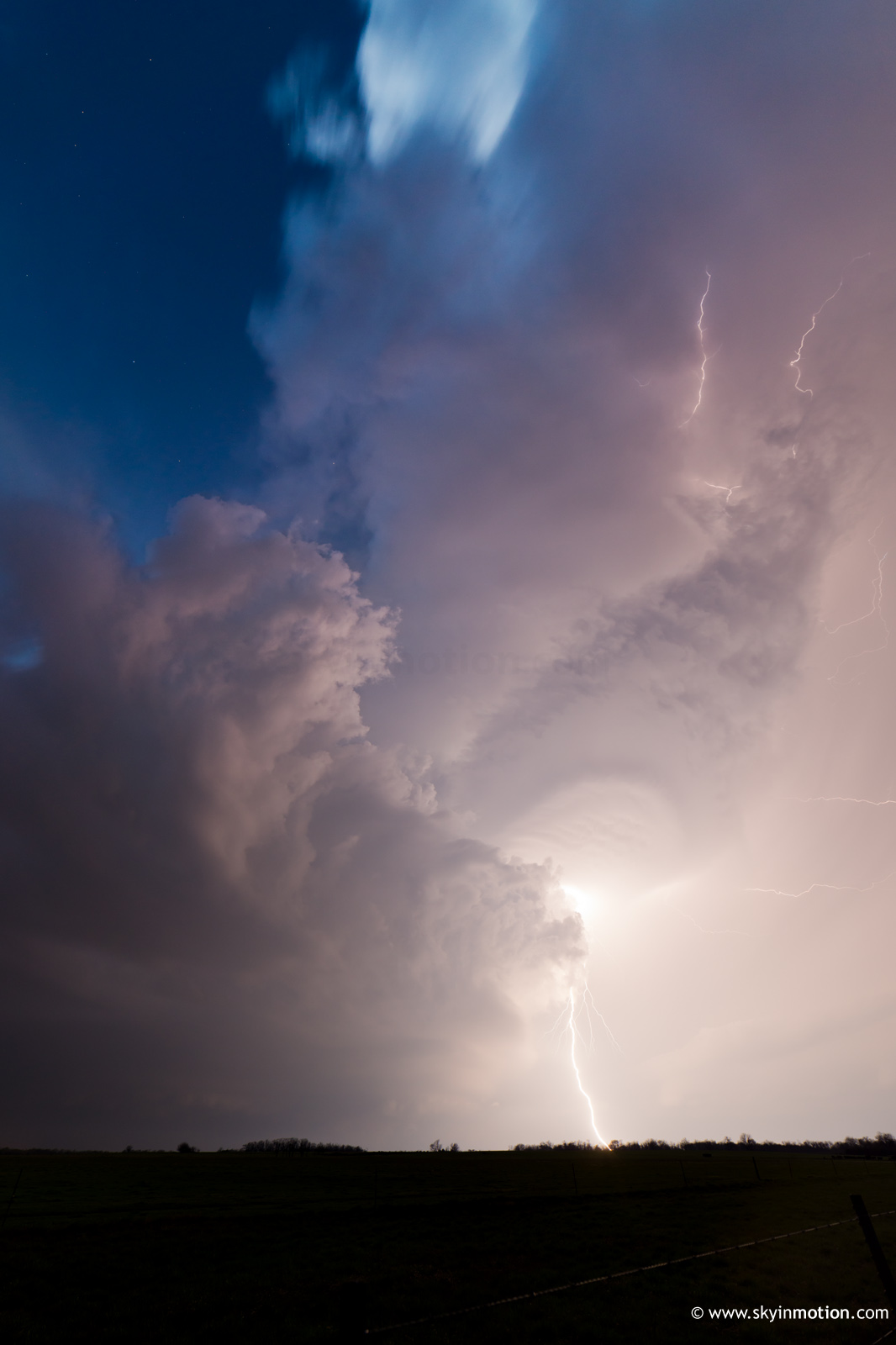
Afterwards, we followed the increasingly HP cell into Oswego, but decided to drop it around there due to fading daylight and a hopelessly wet RFD. About 20 minuets later at dusk, I was happy with this decision, as it allowed us to take some nice stills of the electrically-active new supercell to the W from near Chetopa.
Not a bad outing for early April. It was hard not to grit our teeth at the thought of what might've transpired near Altamont had T/Td spreads been 3-5 F lower, but that's early-season chasing for you (usually).