

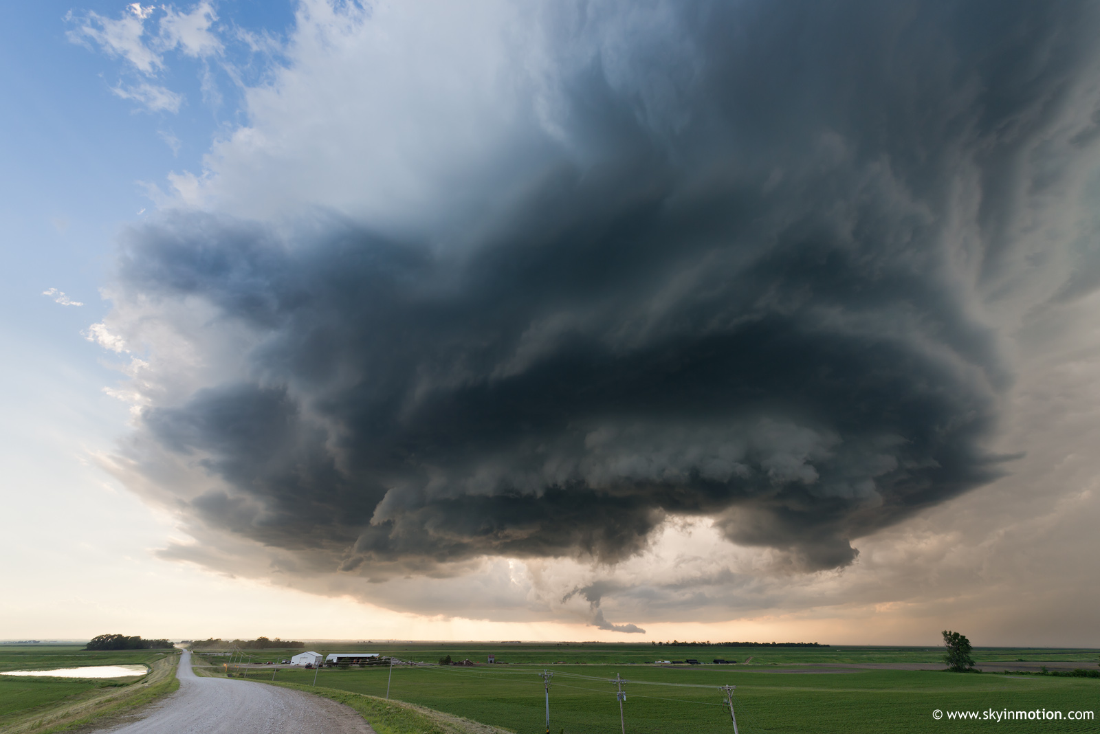
I had my eye on 6/20 for several days, but was unconvinced it would be worth the multi-day outing (notwithstanding further potential from 6/21-6/23). Only with the 00z CAM suite the night before did I decide to pull the trigger, as strong agreement existed for long-lived NW flow supercells rampaging down the Missouri River Valley from mid-afternoon into the evening. My biggest concern at that point was a rapid transition to HP character. By mid-late morning Thursday, the issue quickly shifted to whether CI was even a given, no thanks to remnant cloud cover from overnight elevated activity.
I arrived in Missouri Valley, IA, by 1:30pm, having prepared for an early show. This was not to be: I crossed back into NE, then meandered the stretch from Blair to Sioux City watching numerous updrafts fight in vain for their lives, including even some that grew to 35k ft. and precipitated. The reality of a complete cap bust became stark by 4pm, when I was forced to cross back to the IA side at Sioux City in lockstep with two turkey tower families. Eventually, the northern of the two sprouted a legitimate updraft with hardened anvil just NNW of town. I watched it for a good hour or so to its SSE. I'm not sure I've ever seen such a visually impressive (relatively speaking) and long-lived storm struggle so mightily against the cap without simply dying in short order. It was very much LP and strongly tilted (perhaps at 45 degrees or greater, from a visual estimate), produced an almost immediate and substantial wall cloud, exhibited periodic RFD cuts and even stubby funnels -- yet only briefly warranted a SVR warning, and never looked like much on radar. I shot a few stills, but haven't bothered to process those.
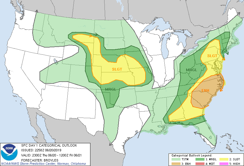
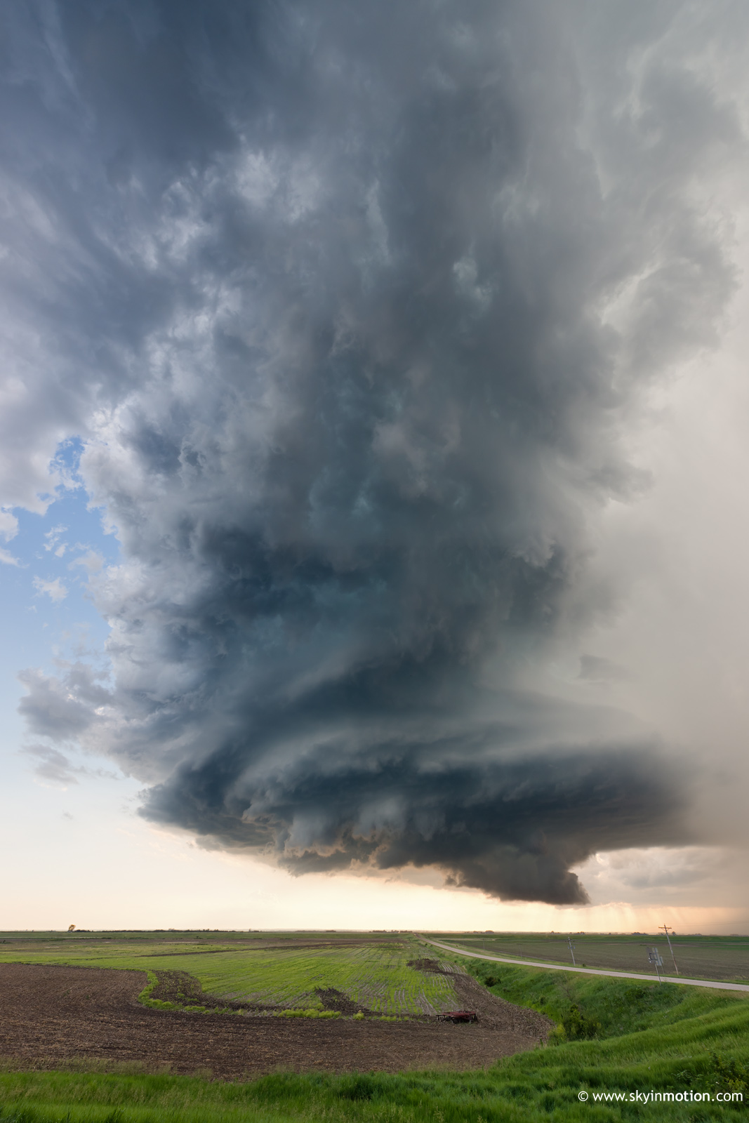
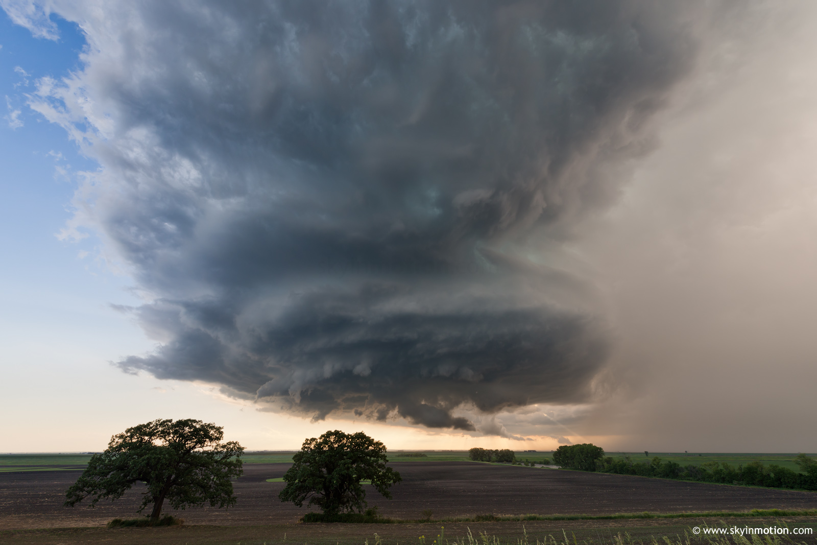
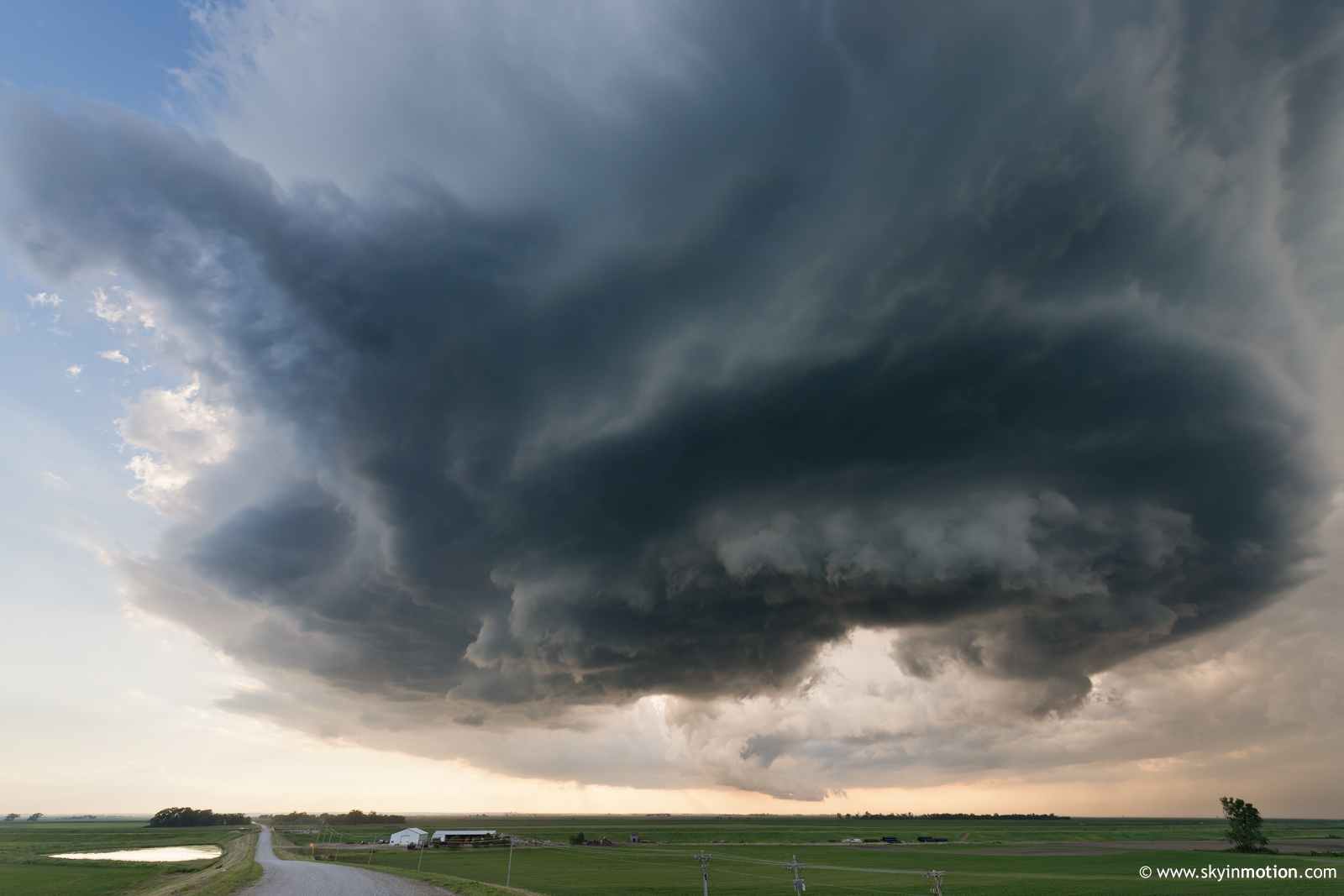
The southern updraft cluster all but collapsed as this Sioux City LP pulsated and teased chasers, but ultimately came back with a vengeance around 6:30-7pm. We all gradually migrated down toward Onawa as it became clear new growth in that area was the real deal -- or, at least, closer to it than anything else nearby. I was on the late side in making the jump south, but managed to core punch with no more than pennies or so (a situation that appeared to worsen markedly only 10 minutes later, if reflectivity aloft was any guide). Once in the heart of Onawa, the "storm of the day" as it were rapidly organized and birthed a broad but impressive lowering -- similar to the Sioux City LP, but with far beefier updraft structure and a more menacing FFD to go with.
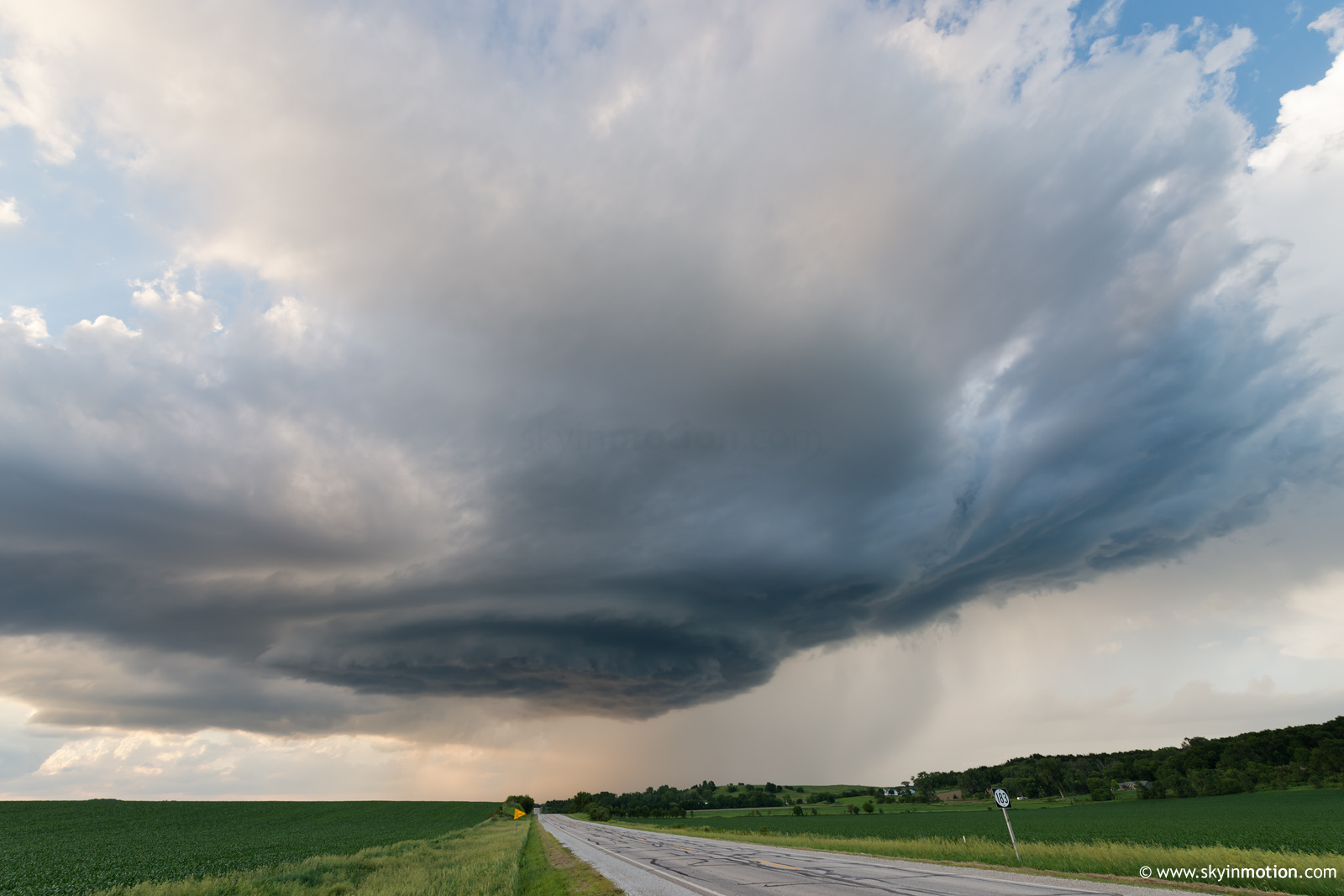
The tornado potential never looked sufficient visually for me to take seriously, so I quickly dove ESE in an effort to hedge toward structure until an alternative was warranted. I was quite surprised how quickly I jumped ahead of virtually everyone on the storm (convergence was not heavy by OK standards, but there must've been at least ~50 chase vehicles around town just prior) -- and I certainly wasn't complaining about it! It was within a 15-minute window here from 7:45-8:00pm, heading E on E54, that I snagged the only photos worth processing. Nestled between the helical updraft and crowds to my W and Loess Hills nightmare terrain just a few football fields to my E, legitimately impressive structure materialized at just the right time for my photography efforts.
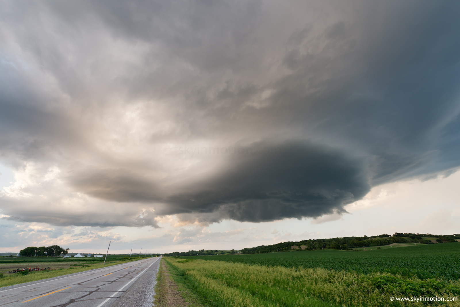
The Loess Hills all but forced me to drop S around their periphery, rather than continuing SE to stay in the optimal structure position, which only helps if your effective horizon isn't 50 degrees after accounting for terrestrial obstacles. By the time I emerged into a good valley around Pisgah, you could say the cap was beginning to win.
Again, though, it was fairly striking how long the updraft persisted in a shriveled, LP, and highly sheared state, rather than simply evaporating as one normally sees under the circumstances. The mesoscale environment (presumably sampled reasonably well by the attached 00z OAX sounding) appeared to support a storm evolution and structure throughout the afternoon and evening that was intriguingly unique, if ultimately rather benign.
Begrudgingly assuming a target of DEN was in store the following day, I ditched the LP (still not completely shriveled into oblivion, mind you) just after sunset and made it to York for the night, only for an intense bowing line segment to plow through town around 2am.